event
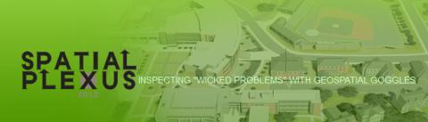
Spatial Plexus 2012
Primary tabs
Conferences are unique opportunities for immersion in an area of interest, direct access to experts, contributions to a field, staying current in an industry, and networking.
Generally speaking, the goal of industry conferences is to bring practitioners to problems (generally organized by subject or track) and highlight concepts and solutions.
The Spatial Plexus '12 inaugural conference takes a twist on this paradigm by bringing problems to the practitioner through the reality of intricate and interdependent issues. "Wicked problems" are those difficult to solve because of incomplete, contradictory, and changing requirements. By "inspecting 'wicked problems' with geospatial goggles," complexities and interdependencies can be exposed, better defined, dissected, better managed through the geospatial approach and reassembled for overall improvements.
Spatial Plexus creates an environment for the following:
- Issue connectivity (i.e., GIS4EconomicDevelopment interactive panel followed by GIS4EconomicDevelopment Ignite Sessions and an "All Hands On-Deck" evening mixer)
- Issue interconnectivity (i.e., Educational articulation, sustainable programs and spatial literacy for workforce readiness followed by GIS4WickedProblems, to include Land, Water, Energy issues)
- Dynamic interaction (i.e., Overview of issues by Keynote speakers and/or panelists, followed by audience discussion and the opportunity to further contribute to issues and issue interdependencies via Ignite sessions)
- Hands-On workshops (i.e., Examining and understanding the U.S. Department of Labor's Geospatial Technology Competency Model and GIS4EconomicDevelopment)
- Information from federal agency leads about GIS funding opportunities
"Wicked problems," such as higher education and economic development, require a great number of people to change their mindsets. What better group to tackle such challenges than geospatial educators, technologists and experts who come from every rank and discipline with the ability to relate issues through geographic visualization and analyses?
Keynote Speakers
- Dave DiBiase, Esri “Ways Forward for Geographic Information Science & Technology”
- Peter Folger, Library of Congress (LOC) Congressional Research Service (CRS)
- Peter Lea, National Science Foundation (NSF)
- Dr. Helen Parker, U.S. Department of Labor (DOL)
Interactive Panels
- GIS4EconomicDevelopment
- GIS4FacilitiesManagement and Operations
- GIS4Health
- GIS4WickedProblems (Land, Water, Energy)
- Opportunities4GIS
Workshops
- 8-hr U.S. Department of Labor's "Geospatial Technology Competency Model" (GTCM)
- 2-hr URISA International's Proposed "Geospatial Manager's Competency Model" (GMCM)
- 8-hr Hands-On: GIS4EconomicDevelopment
The event is co-hosted by GIS@GTRI and the National GeoTech Center.
Media
Summary
By "inspecting 'wicked problems' with geospatial goggles," complexities and interdependencies can be exposed, better defined, dissected, better managed through the geospatial approach and reassembled for overall improvements.
Status
- Workflow status: Published
- Created by: Robert Nesmith
- Created: 04/23/2012
- Modified By: Fletcher Moore
- Modified: 10/07/2016
Categories
Keywords
User Data