Study Shows Underground Fluids May Enable Tectonic Plate Ruptures
Primary tabs
Scientists have long theorized that water plays a role in earthquakes, essentially as a lubricant in the mantle, the area between the planet’s core and the crust. Those fluids were thought to keep ruptures from happening when huge tectonic plates collide just beneath the earth’s surface.
A new study from Georgia Tech shows that fluids from the mantle in Alaska’s Shumagin Gap — an intersection of tectonic plates that has attracted researchers because of the lack of large seismic events — may provide new information about how those fluids could actually help generate earthquakes.
“One common thought is that fluids tend to decrease the chance of large earthquakes by decreasing friction along faults,” says Darcy Cordell, who worked on the research as a postdoctoral scientist in the School of Earth and Atmospheric Sciences at Georgia Tech. “However, our paper suggests that it might not be such a simple story. It may still be the case that fluids help to inhibit the very largest earthquakes, those around magnitude 9.0 on the Richter scale. However, the presence of fluids does not rule out relatively large earthquakes from occurring and, in fact, earthquakes may be more likely to rupture through fluid-rich, conditionally stable areas rather than dry, stable areas.”
Cordell, now a postdoctoral fellow at the University of Alberta, is the lead author of a paper published in Nature Geosciences, “Forearc seismogenesis in a weakly coupled subduction zone influenced by slab mantle fluids.” (A subduction zone is the area where a collision between two of Earth's tectonic plates has happened, with one plate sinking underneath the other into the mantle. A forearc, meanwhile, is the area between an oceanic trench, or a depression in the seafloor, and a volcanic arc, such as a mountain range with volcanoes.)
Cordell’s co-author, Georgia Tech Earth and Atmospheric Sciences Assistant Professor Samer Naif, is joined by research team members from Woods Hole Oceanographic Institute, Scripps Institution of Oceanography, BlueGreen Geophysics, Lamont-Doherty Earth Observatory, and Northern Arizona University. The National Science Foundation provided funding for the research.
The key to the ‘unlocked’ Shumagin Gap
The Shumagin Gap, a segment of tectonic plate boundary located near the Shumagin Islands that lie south of the Alaskan mainland, was considered to be at lower risk of earthquakes because the tectonic plates were thought to be “unlocked” — free of jagged edges that can strike each other and eventually “lock” up and build up stress that can cause earthquakes. But in July 2020, a megathrust quake — where plates violently collide, sending one sliding on top of the other — struck just east of the Gap. That was followed in October of that year with a strike-slip quake (with plates moving horizontally) right in the middle of the Gap.
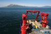
“There are only a few such well documented seismic gaps along subduction zones globally,” says Naif. “We chose the Shumagin Gap and its neighboring segments for our study area for this reason. Our goal was to map the distribution of fluids in order to investigate how fluids might be impacting where earthquakes do and do not occur. When we collected the field data back in 2019, we had hypothesized abundant fluids in the Shumagin Gap to explain the lack of earthquakes. The fact that a pair of earthquakes occurred in this very region just one year later was certainly fortuitous.”
Prior to the research, most discussions about fluids being released from the mantle assumed that the waters were released after the tectonic slab had subducted to depths of more than 100 kilometers. “So instead of having slab mantle fluids released beneath the region where large earthquakes happen, it was thought the fluids would be released much further from the ocean trench,” Cordell says.
In the case of the Shumagin Gap quakes, that would be after the plate was subducted beneath the Alaska Peninsula. This is why slab mantle fluids were not considered to have much of a role in shallow, large earthquakes in the forearc, Cordell adds.
Mapping mantle fluids
Yet that theory was challenged when the team began to locate and map mantle fluid flows. Saline water conducts electricity easily, which allowed Cordell and Naif to use magnetotelluric geophysical methods, which rely on the Earth’s own magnetic and electric fields to produce images of the electrical conductivity underground at 100-kilometer depths. “This helps us locate where saline water is because it lights up bright red in our images,” Cordell says.
The scientists found that water from the plate mantle can indeed be released into the forearc region of the subduction zone, the area where most large earthquakes occur. “This has many implications for how we think about and model subduction zones on geological time scales, and not solely earthquake ruptures,” Cordell says.
Naif maintains that water does tend to lubricate faults, but the study suggests that the presence of water may have also allowed the July 2020 Shumagin earthquake to rupture through low friction portions of the fault. “One way in which this can occur is by dynamic weakening,” he explains — as the fault slips during an earthquake, it could lead to rapid shear heating caused by the slippage, and thermal expansion of the pore fluids (fluids inside spaces in rocks). “Both those actions could further reduce the friction and allow the earthquake to continue to propagate.”
Cordell says the fluids at the interface of the tectonic plates may not uniformly decrease earthquake risk in a simple relationship, “but instead a more complex interplay between fluids, and rupture may actually increase risk in some circumstances.”
Future subduction zone studies
Naif would like to see more mapping of the distribution of fluids for the Shumagin and nearby Semidi segments involved in the July 2020 earthquake. “Our study is along a single profile, and it is not clear whether fluids are present along the entire fault slip surface,” he says.
Naif also wants to see the research expanded “to explore other subduction zones around the world for similar deeply-sourced fluids, and where such fluids are discovered, how they influence seismicity.”
About Georgia Institute of Technology
The Georgia Institute of Technology, or Georgia Tech, is one of the top public research universities in the U.S., developing leaders who advance technology and improve the human condition. The Institute offers business, computing, design, engineering, liberal arts, and sciences degrees. Its more than 45,000 undergraduate and graduate students, representing 50 states and more than 148 countries, study at the main campus in Atlanta, at campuses in France and China, and through distance and online learning. As a leading technological university, Georgia Tech is an engine of economic development for Georgia, the Southeast, and the nation, conducting more than $1 billion in research annually for government, industry, and society.
This work was supported by the National Science Foundation under grant numbers OCE-1654652 and OCE-1654619.
Media


Summary
Earth and Atmospheric Sciences Professor Samer Naif and Darcy Cordell, a former postdoctoral scholar, have uncovered new findings that could change how scientists view water’s role in preventing — or perhaps encouraging — earthquakes.
Groups
Status
Categories
Keywords