news
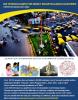
Application Open for GIS Summer Program in Bangalore
Primary tabs
Update: The application window for Summer 2014 is now closed.
GIS is a rapidly emerging field of study, centered on the acquisition, management, analysis, and dissemination of information that is spatially referenced to locations on, above, and below earth’s surface. This field is highly transdisciplinary with growing importance in a number of traditional academic disciplines and related professional fields. It is also becoming an important tool in understanding the conditions of and prospects for underdeveloped regions, which is transforming the process of crafting development strategies. However, the majority of GIS research has been contextually situated in places where data are relatively easily available and can be verified through standardized techniques. In contrast, the problems in developing countries have been issues of “messy,” incomplete, and/or non-existent data, which compels the use of heuristic techniques to acquire and develop shadow data systems for analysis. These techniques, often based on satellite and aerial imagery, are still in their infancy and rarely incorporated in GIS courses. This summer study abroad program will develop a compendium of methods for GIS analyses in data poor regions. By engaging with the real issues of underdevelopment through new forms of GIS techniques we plan to make critical and fundamental contributions to research and training in both GIS and development planning.
The curriculum will be delivered in close partnership with the International Institute of Information Technology (IIIT-B) at Bangalore. IIIT-B is a premier educational institution offering a range of undergraduate and graduate degrees focused on various aspects of information technology that is located at the heart of India’s “Silicon Valley.” The course participants will include Indian students from IIT-B, and possibly from other institutions, who will work on the same projects and learn alongside their Georgia Tech counterparts.
The course will involve intensive application geospatial tools and technologies for pre-selected projects (within reasonable distance from the IIIT-B campus). Students will also have a classroom component with lectures and exercises for 12 hours each week. While most of these lectures will be delivered by the assigned teaching faculty, other personnel from relevant institutions in India and from non-governmental organizations engaged in development work will be invited to share their knowledge and experience. We expect this experience to be both intensive and transformational for the students at multiple levels. The institutional partner, IIIT-B, will provide one faculty member to complement the Georgia Tech faculty assigned to this course. The director of IIIT-B has also committed to provide complementary accommodations to all Georgia Tech students participating this coursework on their campus (their student housing is excellent and offers single-room accommodation to every student). Students can also avail of subsidized meals the institute cafeteria. The intention is to make this experience within financial reach of most students. The Georgia Tech students will experience Indian graduate student life living in their midst, in facilities that are on par with those they are used to in this country.
Media
Summary
This summer study abroad program located in Bangalore, India will develop a compendium of methods for GIS analyses in data poor regions. The curriculum will be delivered by the International Institute of Information Technology (IIIT-B) at Bangalore and Georgia Tech and will engage students with the real issues of underdevelopment through new forms of GIS techniques.
Status
- Workflow status: Published
- Created by: Kyle James
- Created: 12/18/2013
- Modified By: Fletcher Moore
- Modified: 10/07/2016
Categories
Keywords
User Data