event
Places and Spaces: Mapping Science
Primary tabs
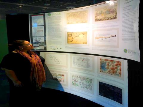
Places & Spaces: Mapping Science is a traveling exhibit meant to inspire cross-disciplinary discussion on how to best track and communicate human activity and scientific progress on a global scale. Maps have an amazing power to help us understand, navigate, and manage both physical places and abstract knowledge spaces.
Patent mapping, one of ten maps in the Places and Spaces exhibit, was devised by a group of faculty, alumni, and close colleagues of the Georgia Tech School of Public Policy: Alan Porter, Jan Youtie, Luciano Kay, Nils Newman, and Ismael Rafols.
The research to develop patent overlay maps that locate bodies of invention activity has been supported by an NSF Science of Science & Innovation Policy (SciSIP) award.
The maps in the Places & Spaces exhibit range from groundbreaking historic maps including a figurative map of Napolean’s march to Moscow, to visualizations such as the US national mood based on tweets and a map illustrating linkages between eight different language Wikipedias. The exhibit is a 10-year effort, with 10 new maps added each year, culminating in a collection of 100 maps submitted by mapmakers across the globe.
Summary
Places & Spaces: Mapping Science is meant to inspire cross-disciplinary discussion on how to best track and communicate human activity and scientific progress on a global scale. Maps have an amazing power to help us understand, navigate, and manage both physical places and abstract knowledge spaces.
Status
- Workflow Status:Published
- Created By:Beth Godfrey
- Created:12/19/2014
- Modified By:Fletcher Moore
- Modified:10/07/2016
Categories
Keywords
Target Audience