news
Georgia Tech Offers New Degree in Geographic Information Science and Technology
Primary tabs
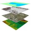
Beginning in Fall 2013 the Georgia Tech School of City and Regional Planning will offer a new professional degree program: the Master of Science in Geographic Information Science and Technology (MS-GIST). Geographic information science (GIS) is an emerging field of study centered on the acquisition, management, analysis, and dissemination of information that is spatially-referenced to locations on, above, and below the surface of the earth. This field is highly transdisciplinary with substantial and growing importance in a number of traditional academic disciplines and related professions including city and regional planning, architecture, civil and environmental engineering, earth and atmospheric sciences, environmental science, demography, logistics, management, public policy, and sustainability studies.
Students can complete the 34 credit-hour curriculum in one calendar year including two semesters of full-time coursework and a capstone project course offered during the summer. Part-time students may complete the program in two or three academic years plus one summer session for the capstone project course.
The MS-GIST degree provides students with a common core of required knowledge, a strong foundation of technology skills, and the flexibility to apply those skills to a broad range of professional and academic fields. Many of the GIST graduates will continue to view themselves as members of traditional professions such as engineering, environmental science, or architecture, but many others will place themselves within the newly-emerging professions directly related to geospatial technologies.
Additional information on the new program is available at
Media
Summary
Beginning in Fall 2013 the Georgia Tech School of City and Regional Planning will offer a new professional degree program: the Master of Science in Geographic Information Science and Technology (MS-GIST).
Status
- Workflow Status:Published
- Created By:Kyle James
- Created:04/11/2013
- Modified By:Fletcher Moore
- Modified:10/07/2016
Categories